
Remote sensing is the process of collecting data about the Earth's surface and atmosphere without direct physical contact, typically using satellite or airborne sensors. These sensors capture electromagnetic radiation (such as light, infrared, and radar) reflected or emitted by objects on the ground.

GIS creates and manages digital map with various layers of geospatial data, supporting navigation through roads, landmarks, and points of interest.

Navigation solutions for better safety and driving experience. SAYEISHAA is an end-to-end service provider in the mapping and navigation geo-content space with the right mix of on-site and off-site teams.

SAYEISHAA provides data-driven urban planning solutions by leveraging advanced geospatial technologies. Our expertise in GIS mapping, remote sensing, and spatial analysis enables us to deliver detailed insights for urban development, infrastructure planning, and sustainable growth. We empower city planners and stakeholders with actionable information to create more efficient, resilient, and livable cities.
Cyclone modeling refers to the process of simulating the behavior and movement of tropical cyclones, also known as hurricanes or typhoons. This type of modeling is an important tool for meteorologists and other weather experts as it helps to predict and track the path of these powerful storms, as well as assess their potential impact on coastal communities and other areas.

Building Information Modelling (BIM) is changing how buildings, infrastructure, and utilities are planned, designed, built, and managed. SAYEISHAA’s BIM team employees market leading modelling software to transform design representation and help turn information into a 3D parametric environment.
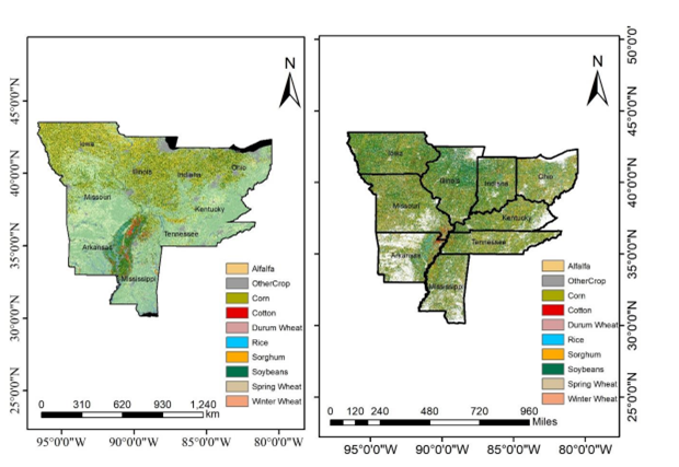
SAYEISHAA leverages advanced geospatial technologies to analyze crop stability and productivity. Through a combination of remote sensing data, GIS mapping, and data analytics, we provide detailed insights into crop health, growth patterns, and potential risks. Our data-driven approach helps agricultural stakeholders make informed decisions for optimized yields and improved crop stability.
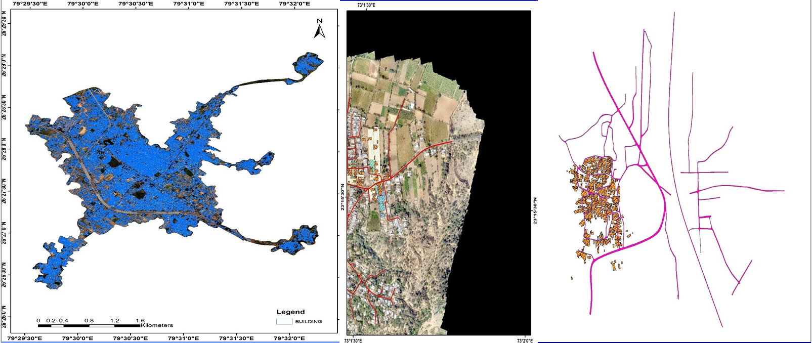
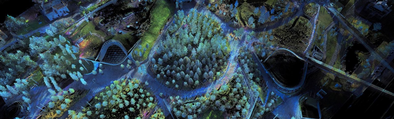
SAYEISHAA utilized QGIS to generate precise 3D building footprints and road networks for various projects. Employing advanced geospatial techniques and data processing workflows, our team extracted detailed building outlines and road geometries, elevating them to 3D representations within the QGIS environment. This project demonstrates our capability to create complex 3D models using open-source tools.
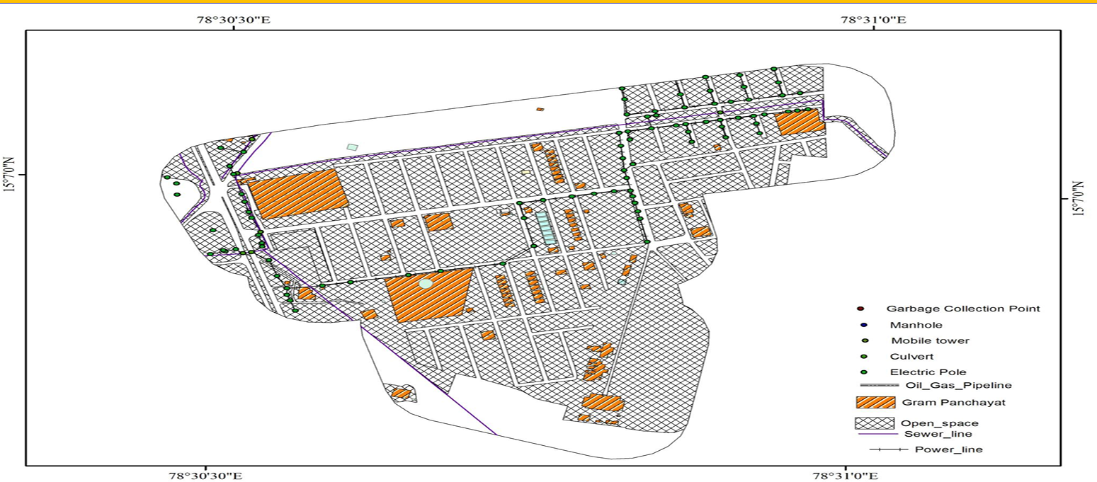
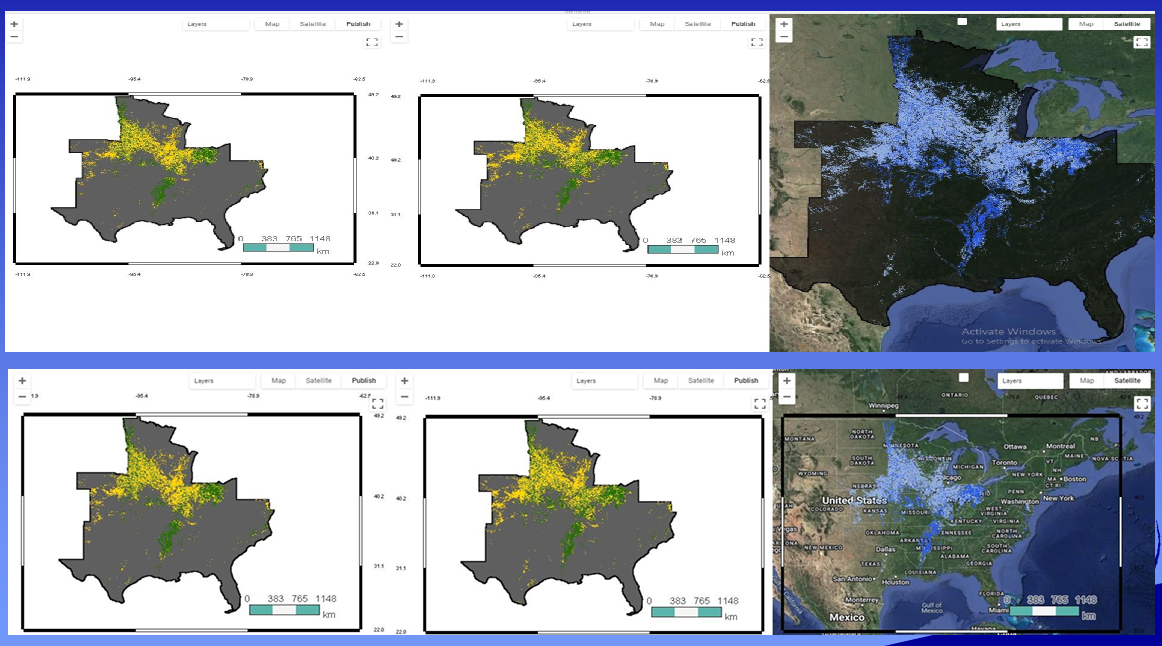
SAYEISHAA leveraged its expertise in both QGIS and ArcGIS to develop a comprehensive base map for various projects. Our team skillfully combined the strengths of both platforms – utilizing QGIS for open-source data handling and processing, and ArcGIS for advanced cartographic design and publishing. This resulted in a highly accurate and detailed base map, providing a robust foundation for subsequent spatial analysis and decision-making.